


The Metropolitan Region of Rio de Janeiro (RMRJ) has long been plagued by rampant armed violence, disrupting daily life for many of its residents. In a city where violence and crime vary from neighborhood to neighborhood, understanding the geographic distribution of violence is pivotal to addressing the problem effectively, or to at least understanding how to live with it the best way possible.
By examining data from 2017 to 2022 and offering a preliminary analysis for 2023, both reports emerging from the collaboration between the Grupo de Estudos dos Novos Ilegalismos of the Universidade Federal Fluminense (GENI/UFF) and the Instituto Fogo Cruzado reveal critical trends and patterns in the metropolitan region of Rio de Janeiro. Through the “Grande Rio Sob Disputa: Mapeamento dos Confrontos por Territórios” (Grande Rio Under Dispute: Mapping Clashes by Territory) and the “Mapa Histórico dos Grupos Armados do Rio de Janeiro” (Historical Map of Armed Groups of Rio de Janeiro) project, these organizations have been mapping and analyzing the impact of armed conflicts in the RMRJ. Since 2019, these projects have provided valuable insights into the territorial control of armed groups, benefiting researchers, policymakers, business leaders, and the general public.
This Content Is Only For Subscribers
To unlock this content, subscribe to INTERLIRA Reports.
Main findings
The study reveals four critical insights into the geography of violence in the RMRJ.
Firstly, there is an immense number of conflicts happening in the different parts of the Metropolitan Region. In the 6 years analyzed, only in the capital, 38.271 armed clashes were recorded.
Secondly, despite the high frequency of confrontations in the RMRJ, conflicts are distributed unevenly and affect less than half of the neighborhoods annually. They vary significantly in intensity and frequency according to the neighborhoods and most neighborhoods experience low-intensity and infrequent conflicts, especially in the South and Center Zones. Only 3.7% of the analyzed neighborhoods face intense and regular violence, indicating that violence issues are hyper-localized. The South Zone, the most densely populated region, experiences the least violent scenario.

Thirdly, the report shows that the dynamics of conflicts in militia-controlled areas differ markedly from those in drug-controlled zones. It indicates that militia territories experience fewer police confrontations, thus in these areas, most conflicts are with other criminal groups. The likelihood of a conflict occurring in an area controlled by a drug gang is 3.71 times higher than in a militia-controlled territory. According to the report, one explanation can be found in the geographical influence of each criminal group, as the percentage of territories under militia control facing conflicts is significantly lower (61.4%) compared to those controlled by drug factions (85.6%). According to INTERLIRA’s analysts, another explanation is historical, and for years, public authorities in Rio de Janeiro tolerated the presence of militias in some regions as their presence created a semblance of public order with no cost for the state. Moreover, the profile of the militiamen, former and active members of public security forces, assured them an apparent legitimacy, in addition to their rejection of engaging in drug trafficking.
Fourthly, the data from the 2017 to 2022 presents a noticeable decline in violent confrontations in the contemplated area. Starting at 6,202 confrontations in 2017, the number peaked at 9,354 in 2018, however, from 2019 onwards, there was a steady decrease, with confrontations dropping to 7,704 in 2019, 5,441 in 2020, 5,068 in 2021, and reaching a low of 4,502 in 2022.
Mapping the conflicts
The graph above reveals that despite Rio’s West Zone being the biggest one, corresponding to 62% of RMRJ’s territory, it concentrates less than 30% of the total conflicts in the RMRJ. Even though the North Zone is quite smaller than the West, only 31% of the territory, it accounts for about 57% of the total conflicts in the RMRJ. The other zones (South and Downtown) are pretty much equivalent.
The significant difference in conflict patterns between the West and North Zones can be attributed to the nature of control exercised by militias versus drug gangs. While militias may suppress overt violence to maintain their hold on power and economic activities, drug gangs’ operations inherently involve frequent violent encounters between competing factions and with the police.
Differences and Similarities amongst Rio’s Zones
North Zone
The North Zone is the region with the highest number of confrontations (11,433), accounting for 57.3% of the capital’s total conflicts. This region, spanning 208 km² with a population density of 13,189 inhabitants per square kilometer, houses 2,753,266 residents, making it the second most densely populated area in Rio. Notably, only 5.9% of its neighborhoods do not experience confrontations, indicating widespread conflict.
Despite most neighborhoods facing low-intensity conflicts (53.3%), the North Zone has the second-highest concentration of high or very high-intensity conflicts (23.3%). The high conflict frequency is attributed in the report to the dominance of drug gangs, which engage in intense turf wars and battles for control over drug trafficking routes. This competition between rival gangs and clashes with police forces – as highlighted in the report – is said to exacerbate the situation, leading to a higher incidence of conflicts. Indeed, those drug gangs in the North Zone engage in drug trafficking, arms trafficking, and cargo theft, resulting in violent confrontations. According to the report, these areas exhibit a higher incidence of violence, with 78.8% of drug gang-controlled territories experiencing conflict compared to 65.5% in non-drug gang-controlled regions.
In terms of confrontations per square kilometer, the report points out that the North Zone scores high (55) compared to the city average (29). The region also leads in neighborhoods experiencing a high regularity of confrontations (26.5%), pointing to chronic insecurity, although the majority faces low regularity conflicts (41.3%).
In territories dominated by drug factions such as Pure Third Command, the Red Command, and Friends of Friends, over 70% reported police involvement in conflicts. Conversely, only 31.6% of militia-controlled areas saw police confrontations.

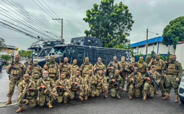
Photo Credits: Secretaria de Estado de Polícia Militar do Rio de Janeiro
West Zone
The West Zone, the largest in terms of territory, registered 5,787 confrontations, accounting for 29% of the RMRJ’s total conflicts. With an area of 424 km², representing 9.1% of the surface of the RMRJ, it has the lowest number of confrontations per square kilometer (13.6). Most neighborhoods report low-intensity conflicts (55.2%), slightly above the city’s average (54.3%), and it ranks second in neighborhoods with very high regularity of confrontations (21.5%).
Despite te recent war waged by the CV, Militias dominate the West Zone, differing from drug gangs by engaging in extortion and controlling local economies, often operating with semi-legal status due to connections with authorities. This results in fewer overt violent confrontations as militias suppress violence to maintain control. Only 31.6% of militia-dominated areas saw police confrontations, compared to higher rates in drug-controlled areas.
A 2021 report, “Mapa Histórico dos Grupos Armados do Rio de Janeiro” (Historical Map of Armed Groups of Rio de Janeiro) highlighted the distinct dynamics of militias and drug factions. Militias expand through extortion in poor areas, while drug factions dominate favelas with drug trafficking. Both contribute to regional violence, with more intensive police confrontations in drug faction territories.
Downtown Rio
Despite having the smallest of conflicts reported, the center exhibits the highest number of confrontations per square kilometer (63.3) and has the highest proportion of neighborhoods with medium to very high-intensity conflicts (51.6%). It records 6,8% of the capital’s confrontations but has the highest intensity, with 34.9% of its neighborhoods facing high or very high-intensity conflicts. This is mainly due because city centers are historically a place of transit, in which few people live but a lot of people work, where more petty crimes are committed. Hence, some rates of local violence tend to express a scenario that is worser than the reality.
South Zone
The most touristic region of Rio, the South Zone, is the most densely populated region of Rio with 21 077 inhab./ km². However, despite its high density, the South Zone experiences the least violent scenario. The region has only 6.9% of the capital’s confrontations, or the second smallest total number of armed clashes, 1,373. It has the highest proportion of neighborhoods with low-intensity (65.7%) and low regularity (57.4%) conflicts. It also stands out with the fewest neighborhoods facing high regularity of confrontations (9.3%). However, due to its small surface, the South of Rio has a higher number of confrontations per square kilometer than the West Zone (46.4).
Changes in Rio’s Criminal Landscape
Despite highlighting relevant trends, the report used is limited since the data provided stops in 2022. Since then, many changes occurred and are not reflected in this study, such as the fact that now militias are taking part of the drug trafficking, form new alliances and fight to expand their territory. By 2022, some militias began forming alliances with drug traffickers, such as the Red Command, creating a phenomenon investigators call “narcomilícia” (narcomilitia). An example of this can be seen in Gardênia Azul in the west of Rio.
Furthermore, data used in another complementary report made by the same authors named “Conflictive Disputes between Armed Groups and Police Forces in Rio de Janeiro” shows that the landscape of armed group control in Rio has changed significantly over the last six years. The Red Command remains the dominant force, with a notable increase in its territories (+12,6% over the period 2017-2023 and controls over 2.249 territories). Militias and the Pure Third Command have also expanded their influence (+10,3% and +64,7% respectively), while Friends of Friends has significantly weakened (-76,4%). Because of the substantial gains by the Red Command and the growth of Milícia and the Pure Third Command, the report suggests a shifting power balance, while the significant losses for Friends of Friends indicate a decline in their influence.
